吐槽
China’s Pinglu Canal linking Guangxi with ASEAN completes its first full-route patrol, paving way to September opening_我的网站

A |
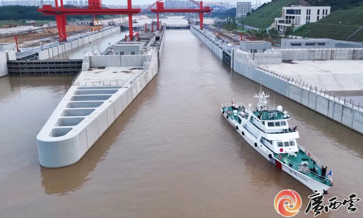
The inspection was carried out from Friday to Saturday by the Guangxi Maritime Safety Administration using the patrol vessel Haixun 1003.
Starting from the canal's seaward entrance, the vessel traveled northward along the entire waterway, passing through the Qingnian, Qishi and Madao ship locks, which remain under construction, while inspecting construction vessels operating along the route. It arrived at the Pingtang River estuary on the afternoon of Saturday.
It was the first time a vessel had completed the entire 134.2-kilometer journey following completion of the canal's main works, representing a breakthrough in full-route navigation tests using an actual vessel, according to Guangxi Daily.
The Haixun 1003 is the first offshore patrol vessel deployed by China's Ministry of Transport at Qinzhou Port. The vessel is 46.1 meters long and 6.8 meters wide, with a maximum speed of 25.3 knots and a cruising range of 500 nautical miles. It can withstand winds of up to Force 9 on the Beaufort scale, roughly 76-87 km/h usually with waves 6-9 meters.
The vessel is also equipped with an advanced marine electro-optical tracking and evidence-collection system capable of operating in color, monochrome, infrared and laser modes under different weather and lighting conditions. The system supports integrated data collection and transmission, Guangxi Daily reported.
During the patrol, maritime authorities conducted on-site inspections of key navigation conditions, including channel dimensions, curved sections of the waterway, navigational clearance beneath bridges, ship-lock approach channels and the mouths of tributaries.
The patrol was also designed to test the practicality of provisions contained in the Regulations on Navigation Safety Management of the Pinglu Canal, which are expected to take effect when the canal opens in September.
The results will provide a basis for refining vessel navigation rules and improving measures intended to safeguard traffic along the canal, according to the report.
Lü Jin, deputy director of the Qinzhou Maritime Safety Administration, said the inspection aims to assess the canal's navigational environment, verify whether navigational aids had been positioned appropriately, identify safety risks along the route and locate waters that could be used during emergencies.
The findings will also support the formulation of on-site supervision plans and help ensure that the canal opens safely and in an orderly manner on schedule, Lü said, according to Guangxi Daily.
The Pinglu Canal is a key project of the New International Land-Sea Trade Corridor. With total investment exceeding 70 billion yuan ($10.37 billion), the canal begins at the Pingtang River estuary in Hengzhou, administered by Nanning, follows the Qinjiang River into the Beibu Gulf, according to Xinhua News Agency.
It is China's first major river-to-sea canal project planned and coordinated at the national level since 1949 and is designed to accommodate vessels of up to 5,000 tons.
Once operational, the canal will give inland regions in Southwest China a more direct river route to the sea. Cargo that previously had to travel eastward through the Guangzhou port will be able to head south directly toward ports in the Beibu Gulf, shortening some inland waterway journeys by about 560 kilometers, according to Xinhua.
The New International Land-Sea Trade Corridor is an international trade and logistics network connecting China's western regions to ASEAN countries and other overseas markets.
It links the Silk Road Economic Belt in the north with the 21st Century Maritime Silk Road in the south while coordinating with the Yangtze River Economic Belt. China's National Development and Reform Commission released an overall plan for the corridor in 2019.
The corridor has continued to record strong trade growth. During the first half of 2026, imports and exports transported through the corridor by its participating regions reached 517.23 billion yuan, up 13 percent year-on-year and setting a new record for the same period, per data released by Chongqing municipal government.
The successful full-route patrol represents a crucial step in maritime authorities' preparations for the opening, providing data from actual vessel operations needed to improve navigation management, emergency planning and safety arrangements ahead of commercial operations, Guangxi Daily reported.
Global Times
。 A Google Maps user noticed an object which resembled a fully intact airplane lying on the ground in the Cardwell Range, about 155 miles south of Port Douglas on the Queensland coast, Australia.,According to the Daily Mail, the image could show an Airbus A320 or a Boeing 737 plane flying very low, giving an impression that it was on the ground.,However, Australian safety officials reportedly suggested that it was probably just a glitch in Google’s satellite software.,“There appears to be a phenomenon called ghost images and that could be what this is,” Australia’s Civil Aviation Safety Authority told the media.,It added that it wasn’t aware of any missing passenger jets.,Google has not yet commented on the case in Queensland.,So-called "ghost" planes have been noticed by eagle-eyed users before, and Google has already explained that satellite images appearing on the Google Maps website are compilations of several images which occasionally causes fast-moving objects such as planes to show up in only one of the many images being used for a given area.。

B |
Current article:http://ltzcgsz.cousizhegaobaolengkuo.bond/list_bve/getq.html
Published on:12:31:41